Hurricane Erin is gaining strength as it approaches the mid-Atlantic coast of the United States, prompting beach closures from the Carolinas to New York City. Forecasters warn that the storm could re-intensify into a major hurricane, with the outer edges already affecting the North Carolina Outer Banks. While Erin is expected to turn out to sea without making landfall, its impact is already being felt along the coast.
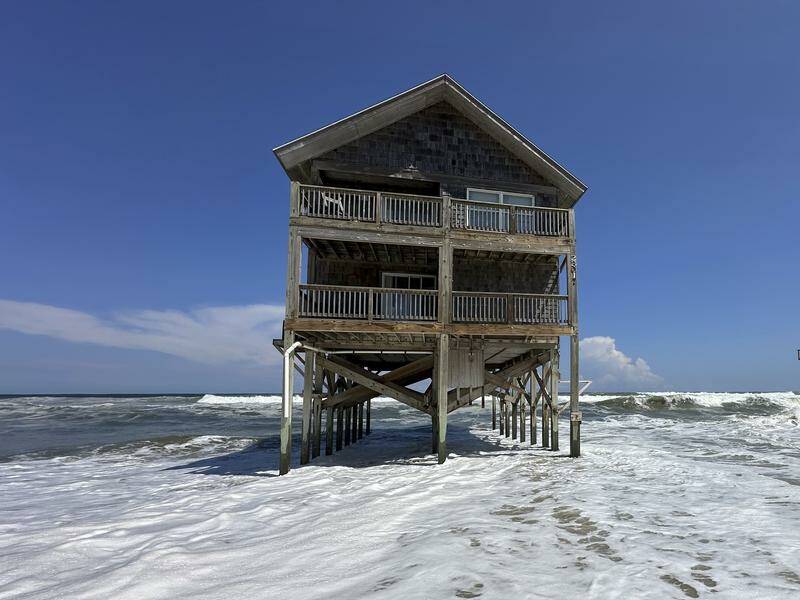
As of August 30, 2023, the storm’s outer bands are generating dangerous conditions, including tropical force winds that have begun to close popular beaches. Authorities report that water is surging onto the main route connecting North Carolina’s barrier islands. Communities and vacation homes in the Outer Banks are at risk, with officials predicting that high tide will result in substantial flooding and life-threatening rip currents from Florida to New England.
New York City has implemented swimming bans at its beaches for Wednesday and Thursday, while closures have also been announced in parts of New Jersey, Maryland, and Delaware. Nantucket Island could experience waves exceeding 3 meters later this week, a situation that has raised alarms among local officials.
Despite the warnings, some swimmers continue to venture into the ocean. On Tuesday, rescuers at Wrightsville Beach in North Carolina saved more than a dozen individuals caught in rip currents, following an earlier incident where over 80 people required assistance. David Hallac, superintendent of the Cape Hatteras National Seashore, has emphasized that coastal flooding from winds and waves—estimated to reach 6.1 meters—could threaten numerous beachfront properties already compromised by erosion and storm damage.
The National Hurricane Centre is monitoring two additional tropical disturbances east of Erin that have the potential to develop into named storms. Erin is classified as a strong Category 2 hurricane, with maximum sustained winds reaching approximately 180 kph. At present, the storm is located about 480 kilometers south-southeast of Cape Hatteras, North Carolina.
Climate scientists are increasingly concerned about the trend of rapid intensification of Atlantic hurricanes, which are becoming more powerful due to warmer ocean temperatures. Erin has emerged as a particularly large storm, with tropical storm winds extending over 800 kilometers.
As the situation develops, residents and visitors along the East Coast are urged to remain vigilant and adhere to safety warnings issued by local authorities. The potential for further intensification of Hurricane Erin underscores the importance of preparedness in coastal communities facing the threats posed by tropical storms.


