


adfg
Residents in Western Australia’s South West are preparing for a significant weather event as the region braces for the strongest storm front of the year. Beginning Sunday afternoon and extending into Monday night, two cold fronts are expected to unleash intense weather conditions across the southwest coastline.
The Bureau of Meteorology has issued warnings for “vigorous northwesterly winds” with gusts reaching up to 100 km/h. Mandurah, in particular, is on high alert as forecasts predict “locally destructive wind gusts” exceeding 125 km/h, posing a risk of significant damage to homes and property. The affected areas include Albany, Bunbury, Esperance, Katanning, Mandurah, Manjimup, Margaret River, Mount Barker, Narrogin, Northam, and Perth.
Weather Patterns and Predictions
The initial cold front on Sunday is expected to bring heavy rainfall, with six-hourly totals between 30-40mm, raising concerns about potential flash flooding. Following a brief respite overnight, a second, more powerful front is anticipated on Monday. According to the Bureau of Meteorology, “The front crossing on Monday is stronger; people in the southwest of WA experience fronts as windy as this about five times per year. This second front will be the strongest front of the year to date.”
“Locally destructive wind gusts above 125 km/h and the possibility of significant damage to homes and property.” — Bureau of Meteorology
Preparation and Safety Measures
In response to the severe weather warnings, the Department of Fire and Emergency Services has urged residents to take precautionary measures. Recommendations include securing loose outdoor furniture and assembling emergency kits to ensure readiness for potential power outages or evacuations.
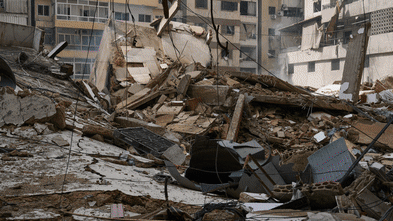
Historically, the South West region has faced similar weather challenges, with past storms causing extensive damage and disruption. The current weather system is being closely monitored, and authorities are on standby to provide assistance as needed.
Community Impact and Response
The announcement comes as the community reflects on previous weather events that have tested the resilience of local infrastructure and emergency services. Local governments are coordinating with state agencies to ensure a swift response to any incidents resulting from the storm.
Meanwhile, residents are being encouraged to stay informed through official channels and heed any further advice from authorities. The situation is expected to stabilize by Monday evening, as conditions ease from the west.
“The front crossing on Monday is stronger, people in the southwest of WA experience fronts as windy as this about five times per year.” — Bureau of Meteorology
Looking Ahead
As the region prepares for the incoming storm, the focus remains on community safety and resilience. The experience gained from past weather events will be invaluable in managing the current situation. Authorities continue to emphasize the importance of preparedness and vigilance in the face of extreme weather conditions.
Residents and businesses are advised to monitor weather updates and maintain communication with local emergency services. The coming days will test the preparedness and adaptability of the South West, but with coordinated efforts, the community aims to weather the storm and emerge stronger.