


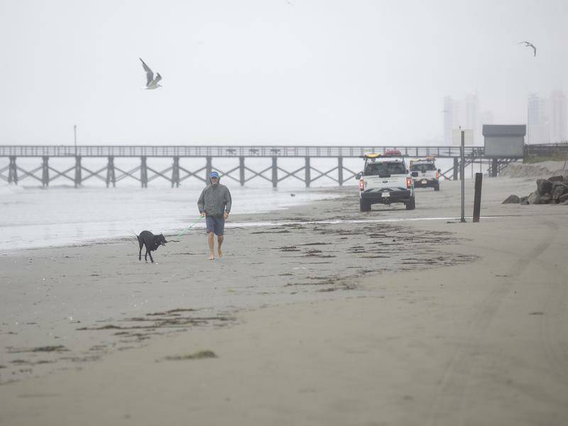
Tropical Storm Chantal has formed off the southeastern coast of the United States, prompting the National Hurricane Center in Miami to issue tropical storm warnings for parts of the Carolinas. As the storm approaches, residents in these areas are bracing for tropical storm conditions expected to hit later on Saturday.
At 9 a.m. EDT on Saturday, Chantal’s center was located approximately 240 kilometers south-southeast of Charleston, South Carolina, and about 385 kilometers south-southwest of Wilmington, North Carolina. The storm is currently moving north at a speed of 4 kilometers per hour with maximum sustained winds recorded at 65 kilometers per hour. The National Hurricane Center anticipates that the center of Chantal will make landfall along the South Carolina coast by Sunday morning, with some potential for additional strengthening before it reaches the shore.
Preparing for Impact
The announcement comes as communities along the southeastern coast prepare for the storm’s impact. Local authorities are urging residents to secure their properties and stay informed through official channels. Emergency services are on high alert, ready to respond to any incidents resulting from the storm’s passage.
According to meteorologists, the slow-moving nature of Chantal could result in prolonged periods of heavy rainfall, leading to potential flooding in low-lying areas. Residents in these regions are advised to have emergency kits ready and to follow evacuation orders if issued.
Historical Context and Comparisons
This development follows a series of weather events affecting the southeastern United States in recent years. The region is no stranger to tropical storms and hurricanes, with historical data showing a pattern of increased storm activity during the late summer and early fall months.
Experts note that while Chantal is currently classified as a tropical storm, the possibility of it intensifying into a hurricane cannot be ruled out. This scenario is reminiscent of previous storms that have rapidly gained strength before making landfall, underscoring the importance of preparedness and vigilance.
Expert Opinions and Future Implications
Meanwhile, climate scientists continue to study the factors contributing to the frequency and intensity of tropical storms in the Atlantic. Some researchers point to climate change as a significant driver, with warmer ocean temperatures providing more energy for storm development.
“The increase in sea surface temperatures is a critical factor in the formation and intensification of tropical storms,” said Dr. Emily Carter, a climatologist at the National Oceanic and Atmospheric Administration. “As our climate continues to change, we may see more storms like Chantal forming earlier and with greater intensity.”
The move represents a broader trend of increasing storm activity in the Atlantic basin, prompting discussions about the need for improved infrastructure and emergency response strategies in vulnerable coastal areas.
Looking Ahead
As Chantal approaches the coast, residents and officials alike are keeping a close watch on updates from the National Hurricane Center. The next few days will be critical in determining the storm’s ultimate impact on the southeastern United States.
Communities are advised to remain vigilant and to heed all warnings and advisories issued by local authorities. The situation remains fluid, and further updates will be provided as new information becomes available.