


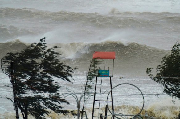
Typhoon Kajiki has severely impacted Vietnam’s north central coast, unleashing torrential rains that have resulted in widespread flooding and significant damage. By 09:00 GMT on Monday, Kajiki was situated along the coast of Nghe An and Ha Tinh provinces, with wind speeds decreasing to between 118 and 133 kph, down from a peak of 166 kph earlier in the day, according to the country’s weather agency.
Residents in the coastal town of Cua Lo reported alarming conditions. “It’s terrifying,” said Dang Xuan Phuong, a 48-year-old local. “When I look down from the higher floors, I can see waves as tall as 2 meters, and the water has flooded the roads around us.”
State media indicated that numerous areas in Ha Tinh province experienced power outages, roofs were blown off buildings, and floating fishing farms were destroyed. In anticipation of the storm, the Vietnamese government had already implemented precautionary measures, including shutting down airports, closing schools, and initiating mass evacuations.
Government Response and Warnings
Authorities had previously issued warnings about “an extremely dangerous fast-moving storm.” They cautioned that Kajiki would likely lead to heavy rainfall, flooding, and landslides. Vietnam’s long coastline, which borders the South China Sea, makes it particularly vulnerable to storms that can be both deadly and destructive.
The government’s proactive approach reflects a growing awareness of the risks posed by climate-related weather events. In the face of increasing storm severity, emergency services are working diligently to assist those affected.
As the storm continues to track through the region, the focus remains on assessing damage and ensuring the safety of residents. Local officials are urging communities to remain vigilant and prepared for further adverse weather conditions in the coming days.