


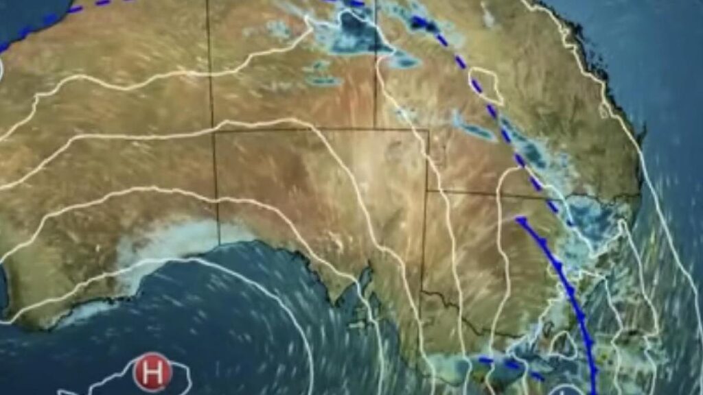
UPDATE: Millions of Australians are facing severe weather threats as dangerous thunderstorms are forecast for Saturday, bringing the risk of large hailstones, destructive winds, and flash flooding. The Bureau of Meteorology (BOM) has issued urgent warnings for residents in New South Wales and Queensland, with storms expected to affect broad areas throughout the day.
The BOM reports that thunderstorms will sweep across the east and north of NSW due to a cold front moving through the state. Key areas including Sydney, the Hunter Valley, and Wollongong could see severe conditions. Christie Johnson, a BOM meteorologist, emphasized the urgency of the situation, stating, “Severe thunderstorms are possible across broad parts of NSW today. This means storms are a risk for much of the east coast.”
Residents in the Sydney metropolitan area should prepare for storms from late morning to early afternoon, with conditions expected to ease later in the evening. The BOM warns that the most severe weather will likely impact the Hunter Region, Mid North Coast, and Northern Tablelands, with wind gusts potentially reaching up to 125 km/h.
“Any storms we see over NSW may bring hail and gusty winds,” Johnson cautioned. “Severe storms could bring damaging wind gusts, hail larger than 2 centimeters, and localized heavy rainfall leading to flash flooding.” The potential for damage to vehicles, properties, and trees is significant, raising concerns about power outages and traffic disruptions.
In Queensland, thunderstorms are also forecast to extend across a wide area, including the Channel Country and Southern Interior. “Moderate rainfall totals are possible with storms across the southeast inland and the far northwest,” Johnson stated, highlighting the risk of severe storms across the Southern Darling Downs and Granite Belt.
As the storms approach, Brisbane and the Gold Coast are not expected to face damaging conditions, but residents should still remain vigilant. Across the state line, Victoria may experience similar storms, although they are likely to be “non-severe.”
Looking ahead, Sydney is bracing for showers and thunderstorms in the late morning and early afternoon, with temperatures reaching a high of 32°C. Meanwhile, Melbourne will avoid the worst of the weather, although it is still expected to receive 15-30 mm of rain.
The forecast indicates significantly cooler temperatures in southern states, with Canberra expecting a maximum of 26°C and possible showers, while Hobart is likely to see a cloudy day with temperatures reaching 15°C.
Residents across the affected areas are advised to stay updated on weather alerts and take necessary precautions as these severe storms develop. The BOM will continue to monitor the situation closely and provide updates as conditions change, urging everyone to remain safe during this hazardous weather event.